County Commissioners Vote Yes On Horse Creek Subdivision
 | Author:
Nancy Marks
Nancy Marks: MT43 News Secretary and News Editor |
Broadwater County Commissioners voted Monday to okay the development of Horse Creek Hills Major Subdivision on Lower Confederate Road, east of Canyon Ferry Lake, despite repeated concerns expressed by nearby landowners.
After a grueling three-hour session, Commission Chair Darrel Folkvord commented, “We voted to approve the sub division with conditions. The reality is that is what the process is about. It is a difficult job and a difficult decision. In the end, the commissioners are tasked with that decision.” He thanked all the organizations, landowners, agencies and officials who worked on the project.
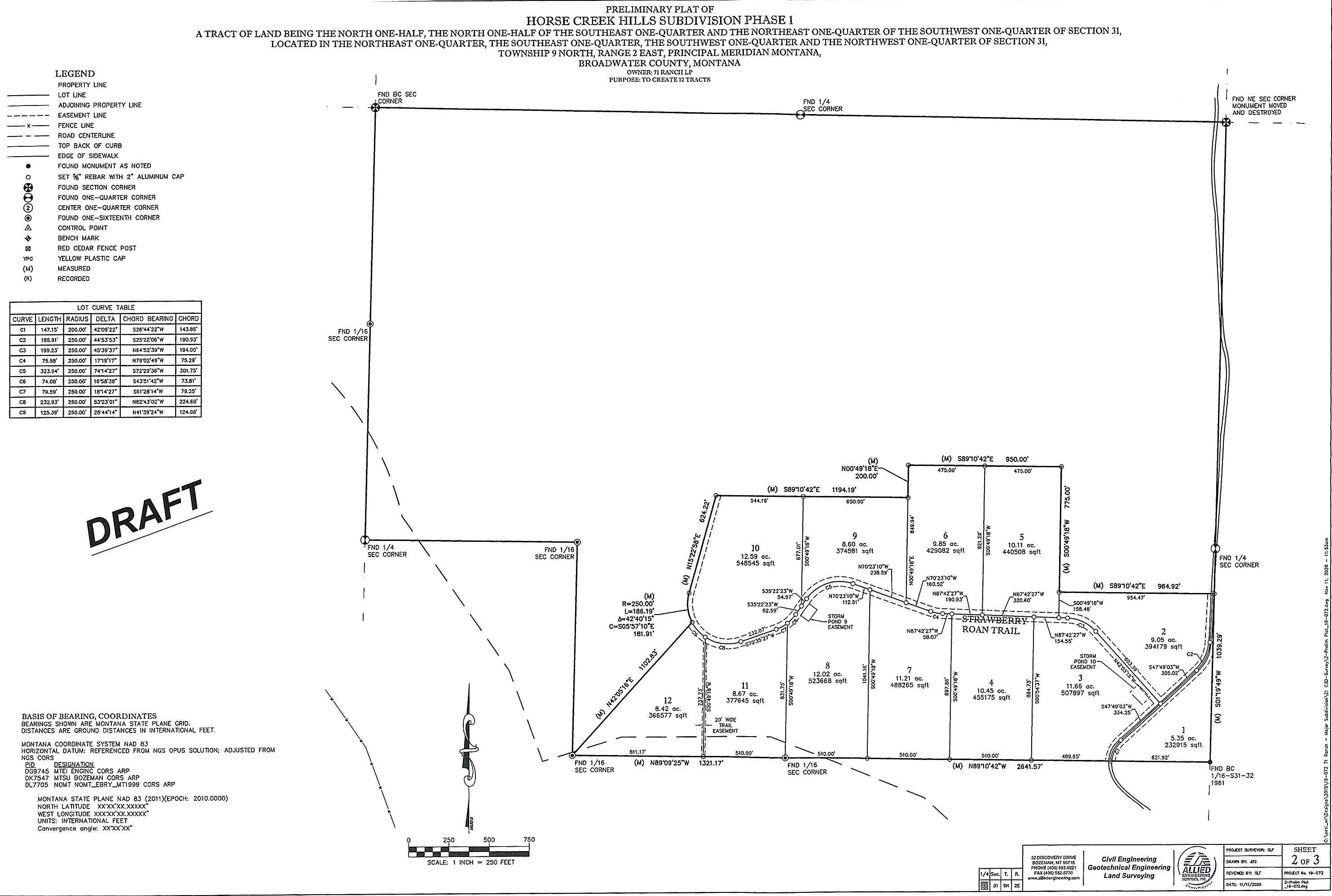
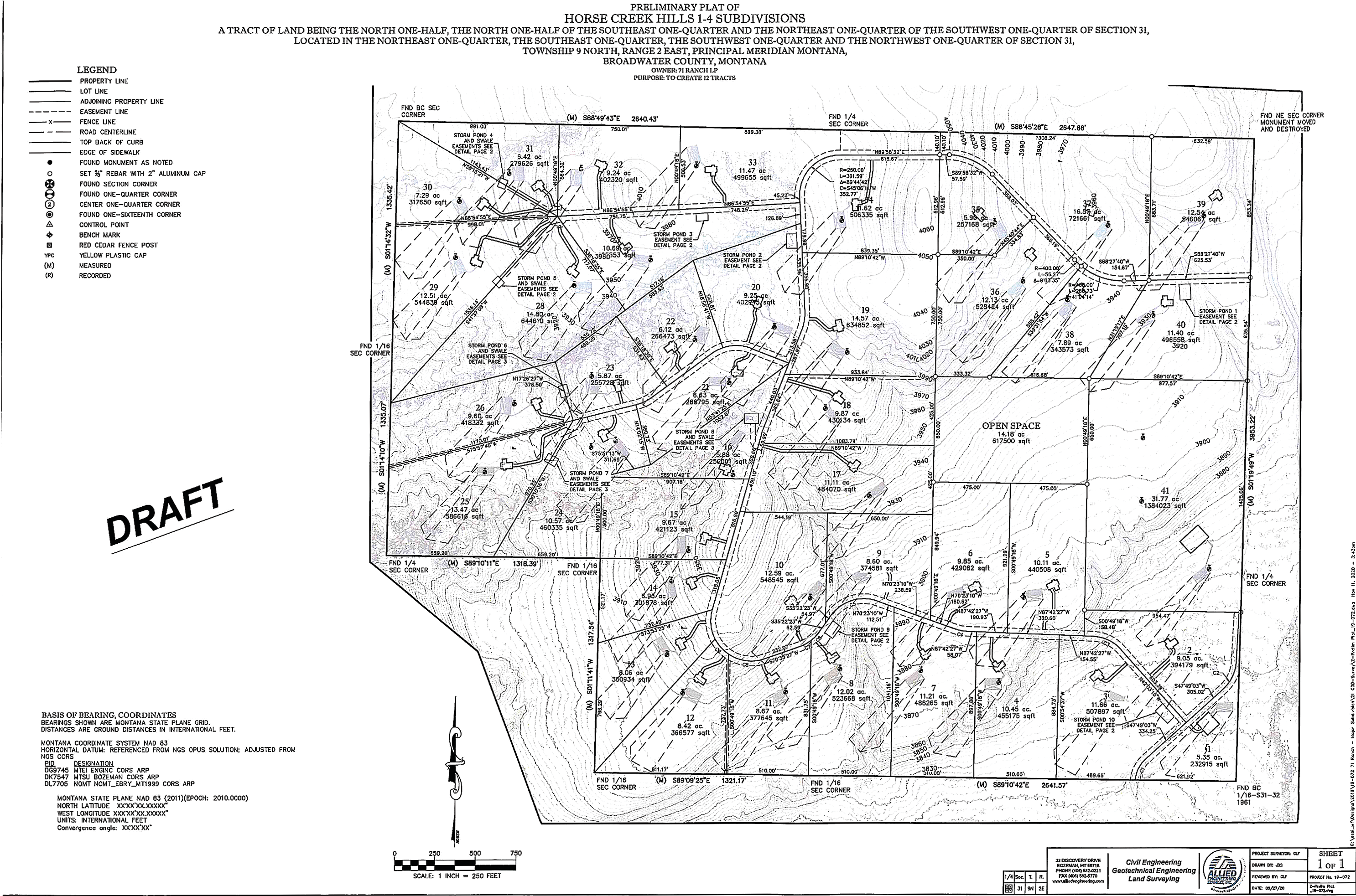
Allied Engineering of Bozeman, agent for landowner 71 Ranch LP, applied for approval in August 2020. The 442-acre subdivision is to be developed in four phases over a period of unspecified years to include 39 residential lots and two commercial lots. The property border lies 260 yards from Canyon Ferry Lake and is 18.5 miles northeast of Townsend. 71 Ranch LP, is owned by the Galt family of Martinsdale, headed by Errol T. Galt. According to tax records, the corporation owns 40 land parcels in Broadwater County. Much of it was originally accumulated by the late land baron Wellington D. Rankin.
Conditions laid down by the commissioners covered issues related to road access, fire and emergency services, water use, agricultural impacts, schools, county growth policy, wildlife habitat and Broadwater County subdivision regulations.
Two issues that stood out at the meetings were road access and water usage by the residents of the subdivision. In the original application, the developer suggested residents would use both Lower Confederate Road and Lower Duck Creek Road. County road supervisor Josh Obert explained in an earlier meeting that Lower Duck Creek Road should be removed as a condition for an upgrade by the developer because it is not all county road. The Bureau of Reclamation owns part of the road and does not regularly maintain it. He said the road is dangerous in winter due to blind curves and washboarding in the summer. The subdivision developer originally included Lower Duck Creek Road as 16 percent daily use by the subdivision residents.
Carole Plymale, an area resident, expressed her thoughts about removing the use of the road by subdivision residents. “I am sad Lower Duck Creek Road has been left out.” She asked if the road would be closed, and if not, how would the county control the traffic.
Residents of the subdivision will access Highway 284 mostly by Lower Confederate Road. The end condition for approval is that the developer pays the county to upgrade the road from the subdivision to Highway 284 in proportion to the subdivision residents’ usage. The work would be completed as the four phases of the project take place. Money for the road work would be placed in a county escrow account so as the project phases in, the road would be upgraded to meet county standards for additional traffic. Actual fund amounts would be calculated on the material and construction prices at the time.
The second major issue before the commission is what impact the new water wells and individual sewer systems will have on the aquifer of the hills and agricultural lands east of the subdivision. The developer set individual annual usage at 10 acre feet. would be allotted 20-acre feet ft per year. Concerns were raised about how much those wells would draw down the aquifer to the east and how would that be measured. Finally, the developer was tasked to add water meters to each homeowner’s well so the data would be available annually.
In order to track the aquifer itself, an approval condition by the commissioners would include a need for a professional study of the hydrology of the aquifer as a baseline.
Landowner and District Conservation employee Denise Thompson referred to Commissioner Mike Delger’s point that additional growth to the east of the proposed subdivision would impact the aquifer as well. “All the future growth will have negative effects on the already fragile aquifer,” she said.
One landowner who ex pressed unhappiness with the commission’s decision was Bill Waldron, whose property is about three miles from the proposed subdivision. He said his land has two landing strips used by Army Special Service Force who train military divers in the lake. He said they have C130 planes flying over the subdivision land. He said the first noise complaint coming from subdivision residents will end the important work of the training. “We have to have someplace to train our services to protect our country,” he said.
Article Images
Click on Image Thumbnail(s) to view fullsize image
PhotoCredit: Broadwater County
Image 1 Caption: Preliminary Plat of Horse Creek Hills Phase 1
Image 2 Caption: Preliminary Plat of Horse Creek Hills 1-4 Subdivisions

